Environment Canada’s Toronto weather service delivers precise, hyperlocal forecasts, current conditions, and air quality readings through, giving you the official data you need to plan your day with confidence. Right now, Toronto’s Air Quality Health Index sits at a moderate risk level of 4, calculated early this morning and holding steady through the weekend, so outdoor plans are safe for most people but worth monitoring if you have respiratory sensitivities.
Unlike commercial weather apps that aggregate data from multiple sources, Environment Canada operates the actual weather stations across the Greater Toronto Area and issues the warnings that local authorities use for emergency planning. The difference matters when you’re deciding whether to bike to work, when a front is moving through, or if wildfire smoke from northern Ontario might affect air quality later in the week.
The platform refreshes hourly observations and updates its seven-day forecast multiple times daily, pulling from radar stations, atmospheric sensors, and meteorological models that track everything from lake-effect snow off Lake Ontario to humidity patterns that trigger summer storms. You’ll find detailed AQHI readings that break down pollutants by type, marine forecasts if you’re heading out on the water, and weather alerts that range from heat warnings to winter storm watches.
Getting comfortable with the interface takes just a few minutes, but understanding how to read the forecast discussion, interpret radar loops, and use the historical data tools transforms you from a casual user into someone who genuinely understands what’s coming and why.
Why Toronto Residents Rely on Environment Canada
Toronto’s weather can shift quickly, from summer heat waves to winter storms that shut down streets, and Environment Canada delivers the forecasts that help residents stay ahead. The service provides city-specific data covering everything from morning frost warnings that protect your garden to air quality readings that tell you whether it’s safe to jog along the waterfront. When moderate air quality risk levels appear, like the current forecast showing AQHI values of 4 through the weekend, locals check Environment Canada first to decide whether to reschedule outdoor plans or adjust their commute.
The value extends beyond simple convenience. Parents use the forecasts to decide if their kids should bike to school or take the bus. Office workers check air quality indexes before planning lunchtime walks. Event organizers rely on extended forecasts to schedule outdoor gatherings months in advance, knowing the predictions come from the same meteorological service that advises provincial emergency management teams.
What sets Environment Canada apart is the reliability. Private weather apps often pull data from multiple sources, creating inconsistencies. Environment Canada operates weather stations across the Greater Toronto Area, feeding observations directly into forecast models every hour. When a winter storm warning goes up or air quality reaches levels that trigger health advisories, the information comes from scientists who monitor actual atmospheric conditions rather than algorithms guessing based on historical patterns.
1. Air Quality Health Index (AQHI) Monitoring

The Air Quality Health Index measures three key pollutants, ground-level ozone, nitrogen dioxide, and particulate matter, that directly affect your health during daily activities. Unlike standard air quality measurements, the AQHI translates complex pollution data into a simple 1-10+ scale that tells you how current conditions might impact your breathing, energy levels, and overall wellbeing.
Here’s how the scale breaks down: readings of 1-3 indicate low risk, meaning most people can enjoy outdoor activities without concern. Moderate risk levels of 4-6 suggest sensitive groups should consider reducing prolonged or strenuous outdoor exercise. High risk readings from 7-10 mean everyone should reduce outdoor exertion, while very high readings above 10 warrant serious activity adjustments for all residents.
As of August 7, 2026, Toronto’s AQHI sits at 4 (moderate risk), with forecasts holding steady at the same level through Saturday. That’s typical summer air quality for the city, calculated at 2:00 AM EDT this morning. You can check these values alongside tools like air quality radar maps to see how conditions are developing across the region.
Toronto residents use these readings to time outdoor runs, decide whether kids should play outside during recess, and determine if elderly family members need to limit their time in the garden. When you see moderate readings like today’s, people with asthma or heart conditions typically scale back intense workouts but continue most normal activities. The forecast maximum helps you plan ahead, if tomorrow shows a jump to 6 or 7, you might schedule that morning jog for earlier in the day or move your afternoon walk indoors.
The AQHI updates hourly, and you can learn to read weather radar patterns that often correlate with air quality changes, like incoming systems that clear pollution or stagnant conditions that trap it over the city.
2. Toronto Weather Forecasts and Warnings
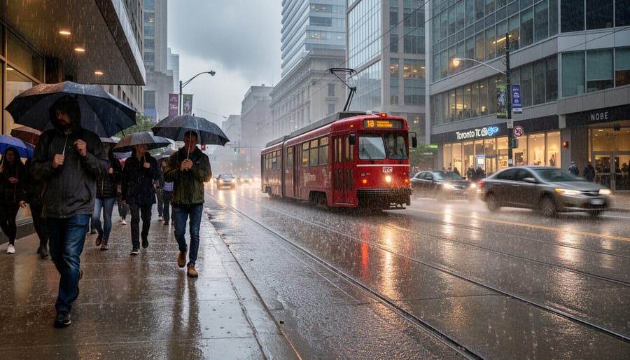
Environment Canada’s Toronto weather forecast system delivers comprehensive predictions that help you prepare for everything from tomorrow’s commute to next week’s plans. The service provides hourly forecasts for the next 24 hours, detailed day-by-day outlooks extending seven days ahead, and long-range trend predictions that give you a heads-up on seasonal shifts. Each forecast includes temperature highs and lows, precipitation probability, wind speeds and direction, humidity levels, and UV index readings.
What sets these forecasts apart is the layered warning system. Watches alert you to potential severe weather 24 to 48 hours in advance, giving you time to reschedule outdoor events or secure loose items. Warnings mean dangerous weather is imminent or already occurring, heavy snowfall, freezing rain, extreme heat, or severe thunderstorms. Advisories cover less severe but still significant conditions that could affect your day. You’ll see these colour-coded on the forecast page, with red indicating the highest urgency.
Toronto’s location makes it vulnerable to rapid weather changes. Lake-effect snow can dump unexpected accumulations in winter. Summer brings sudden severe thunderstorms with heavy rain and occasional hail. Spring and fall transitions create unpredictable temperature swings. Environment Canada’s forecasters account for these local patterns, adjusting models based on real-time observations from weather stations across the Greater Toronto Area.
The seasonal advisory system helps you prepare months in advance. Extreme weather updates during winter outline cold snap risks and snowfall expectations, while summer advisories warn of heat wave potential and air quality concerns. These longer-term forecasts aren’t perfect, but they give you a framework for planning everything from vacation timing to when to schedule roof repairs.
Check the forecast morning and evening during typical weather, but refresh hourly when warnings are active.
3. Real-Time Radar and Satellite Tools
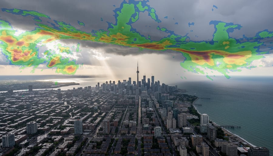
Beyond static forecasts, Environment Canada’s interactive radar and satellite tools let Toronto residents watch weather unfold in real time. The national weather radar network updates every ten minutes, showing precipitation intensity and movement across the Greater Toronto Area. You’ll see rain showers approaching from Lake Ontario or snow squalls sweeping down from Georgian Bay before they reach your neighbourhood.
The radar imagery uses a colour scale: light green indicates drizzle, darker greens show steady rain, and yellows through reds mark heavy downpours or intense snowfall. The loop function animates the past few hours of radar images, revealing whether that line of storms is strengthening, weakening, or changing direction. Locals check this loop before deciding whether to wait out a shower or grab an umbrella for the whole afternoon.
Satellite imagery complements the radar by showing cloud cover patterns across Ontario and beyond. The visible satellite view works during daylight hours, displaying thick storm systems as bright white masses and thinner cirrus clouds as wispy grays. Infrared satellite imagery runs 24/7, highlighting cold cloud tops that typically produce heavier precipitation. Together, these views help you distinguish between a solid overcast that’ll bring hours of rain and scattered clouds that might only drop occasional sprinkles.
Most Toronto residents keep the radar page bookmarked for quick checks during uncertain weather. Commuters pull it up before leaving work to see if that developing cell will hit during rush hour. Parents use it to decide whether soccer practice will happen or get rained out. The tools don’t predict the future, but they show exactly what’s happening now and where it’s headed next.
How to Access Environment Canada Toronto Services
Environment Canada offers several ways to track Toronto’s weather and air quality, each suited to different needs and preferences. Choosing the right combination ensures you catch important alerts and can plan your day around current conditions.
The official website remains the most comprehensive source, displaying detailed forecasts, radar imagery, and current AQHI readings like the moderate risk level of 4 forecasted through Saturday. The desktop site works well for checking multiple data points at once, including the forecast maximums calculated at 2:00 AM EDT each day and understanding how air quality works.
- WeatherCAN mobile app, Free download for iOS and Android with customizable location alerts and push notifications
- Twitter @ECCCWeatherON, Real-time warnings and forecast updates for Ontario regions including Toronto
- Alert Ready system, Automatic wireless emergency alerts for severe weather sent directly to your phone
- Local radio stations, Regular Environment Canada forecast updates during news segments and weather breaks
For personalized notifications, download the WeatherCAN app and enable location services. Tap the settings icon to choose which alerts matter most to you, whether that’s air quality changes, severe thunderstorms, or winter weather advisories. You can set thresholds for AQHI levels, receiving a ping when readings climb from moderate to high risk.
Many Toronto residents bookmark the city-specific AQHI page on their phones for quick morning checks before heading out. Setting up multiple access points means you won’t miss critical updates, whether you’re at your desk, commuting, or out for a run.
Understanding Current Air Quality Data
When you pull up Environment Canada’s Toronto page, the numbers tell a story, but only if you know what you’re reading. The AQHI reading you see isn’t a live measurement from ten seconds ago. It’s calculated at specific intervals, typically every hour during the day. Right now, you’ll notice a timestamp like “Calculated at: 2:00 AM EDT Friday 7 August 2026” at the top of the page. That tells you when Environment Canada last crunched the data from monitoring stations across the region.
The current readings show Thursday night through Saturday holding steady at 4, which sits in the moderate risk zone. But here’s what trips people up: you’ll also see a “Forecast Maximums Next 24 hr” section with its own timestamp (issued at 5:00 PM EDT the previous day). Those forecast maximums represent the highest AQHI level expected during each period, not an average. If you’re planning a morning run, check both the current reading and the forecast maximum for your time window.
The scale itself breaks down like this:
| AQHI Range | Risk Level | Who Should Adjust Activities |
|---|---|---|
| 1-3 | Low Risk | No need to modify outdoor plans |
| 4-6 | Moderate Risk | Children, seniors, those with heart/lung conditions consider reducing intense outdoor exertion |
| 7-10 | High Risk | At-risk groups reduce or reschedule strenuous activities; general population consider reducing intensity |
| 10+ | Very High Risk | At-risk groups avoid outdoor physical exertion; everyone else reduce or reschedule |
That moderate 4 rating means most people can go about their day normally, but if you’ve got asthma or you’re over 65, you might dial back that intense spin class or move your cycling commute to a less strenuous route. The page refreshes multiple times daily, so checking once in the morning gives you a baseline, but a quick refresh before heading out captures any shifts.
Local Tips for Using Environment Canada Toronto
Most Torontonians find the sweet spot for checking forecasts is first thing in the morning and again around mid-afternoon, when updates often incorporate fresh radar data and revised AQHI calculations. If you see a moderate risk reading like the current 4-level forecast, don’t panic, it’s generally safe for most people to carry on with outdoor activities, though those with respiratory conditions might want to scale back intense exercise during peak afternoon hours.
Combine Environment Canada’s AQHI data with local pollen forecasts during spring and summer for a fuller health picture, since poor air quality plus high pollen counts can compound breathing difficulties. When conditions shift rapidly, common during thunderstorm season or when wildfire smoke drifts in from other regions, refresh the page or app every few hours rather than relying on morning data. The radar map becomes your best friend during these periods, showing you exactly when air mass changes will arrive.
Set location-based alerts through the WeatherCAN app so you’re not constantly checking manually, and follow Environment Canada’s Ontario Storm Prediction Centre on social media for real-time updates that sometimes arrive faster than automated alerts. During winter, cross-reference AQHI with wind chill warnings, since cold air can irritate airways just as much as pollution. Many regular users bookmark both the Toronto AQHI page and the local forecast page, toggling between them for decision-making about everything from commute routes to whether the kids should play outside after school.
Common Questions About Environment Canada Toronto
How often does Environment Canada update Toronto forecasts?
Environment Canada updates Toronto weather forecasts multiple times daily, with major updates typically occurring in the morning and evening. Air quality calculations happen hourly throughout the day, with the AQHI forecast maximum issued once daily (currently at 5:00 PM EDT) and hourly observed values calculated continuously.
What’s the difference between AQHI and AQI?
The Air Quality Health Index (AQHI) is Canada’s scale running from 1 to 10+, designed to show health risk from a combination of ground-level ozone, nitrogen dioxide, and fine particulate matter. The Air Quality Index (AQI) is used in the United States and other countries, running from 0 to 500 with different pollutant weighting, so the two numbers aren’t directly comparable.
When should I be concerned about air quality in Toronto?
If you’re healthy and active, pay attention when the AQHI reaches 7 or higher (high risk) and consider reducing strenuous outdoor exercise. If you have asthma, heart disease, or respiratory conditions, even moderate risk levels (4-6) warrant caution, especially during extended outdoor activities.
How accurate are Environment Canada’s Toronto forecasts?
Short-term forecasts (24-48 hours) tend to be quite reliable for general conditions, though exact timing of precipitation or temperature peaks can shift. Extended forecasts beyond three days become less precise but still give you a useful sense of upcoming patterns and potential weather changes.
Can I get alerts for specific Toronto neighbourhoods?
Weather warnings cover broader regions rather than individual neighbourhoods, typically issued for “Toronto” or “City of Toronto.” You can’t customize alerts down to the neighbourhood level, but the forecasts and warnings apply city-wide, and radar tools let you track conditions moving through your specific area.
These questions come up constantly among Toronto residents learning to use Environment Canada’s tools. The update timing matters because if you check the site at 3:00 AM, you’re seeing calculations from 2:00 AM EDT with the previous evening’s forecast maximum still posted. Understanding the AQHI versus AQI distinction helps if you’re comparing conditions with friends in American cities or reading international air quality news. The threshold question gets personal quickly since what counts as “concerning” depends entirely on your health status and activity plans. A moderate risk reading of 4 (like the current Toronto forecast) means something different if you’re planning a casual neighbourhood walk versus training for a marathon.
Whether you’re checking the moderate risk AQHI forecast for your morning run or tracking an incoming weather system on the radar, Environment Canada’s Toronto services have become an essential part of daily life in this city. These tools aren’t just about staying informed, they’re about making smarter decisions that protect your health and help you plan confidently. Bookmark the Toronto weather and air quality page now, and take two minutes to set up mobile alerts for your neighbourhood. You’ll thank yourself the next time conditions change quickly. Got a favourite way to use these forecasts? Drop your tips in the comments below, whether it’s how you combine AQHI with your commute planning or tricks for reading the radar maps, your insights help the whole community stay one step ahead.