When storms roll across the prairies or you need to know if that dark cloud is dropping rain on your fields, real-time weather radar for Strathmore gives you the precise precipitation data you need right now. Southern Alberta’s weather can shift fast, and whether you’re managing crops, planning an outdoor event, or just deciding if you need to bring in the patio furniture, radar tools show you exactly where rain, hail, and snow are moving and how soon they’ll reach your doorstep.
This guide covers the seven best radar sources for tracking weather in and around Strathmore, from official government tools to interactive mobile apps and community weather networks. You’ll learn which platforms update fastest, how to read what you’re seeing on screen, and which sources give you the most accurate picture of conditions heading your way. Each tool has strengths depending on what you need: some excel at severe weather alerts, others offer street-level detail or longer forecast loops.
Understanding how radar works and where to find reliable data helps you make smarter decisions when the weather matters most. We’ve tested these platforms for accuracy, ease of use, and how well they serve the practical needs of southern Alberta residents.
How We Chose These Weather Radar Tools
Choosing the right radar tools means focusing on what actually helps you track storms around Strathmore. We looked at data reliability, local coverage, and how easy each tool is to use when weather turns serious. These aren’t paid recommendations or formal product tests, they’re curated picks based on what works for southern Alberta residents who need accurate, timely information.
Our selection prioritized:
- Data accuracy from trusted sources like Environment Canada and NOAA
- Complete coverage of Strathmore and surrounding areas after the 2019 radar station upgrade
- Update frequency that keeps pace with fast-moving storms
- Interactive features including zoom, animation, and precipitation tracking
- Easy access across phones, tablets, and computers
Each tool earns its spot by delivering reliable radar imagery that complements broader resources like Calgary’s live radar coverage. Whether you’re checking conditions before heading out or monitoring a developing storm, these seven tools give you the information you need without unnecessary complexity.
1. WeatherCAN: Environment Canada’s Official Radar
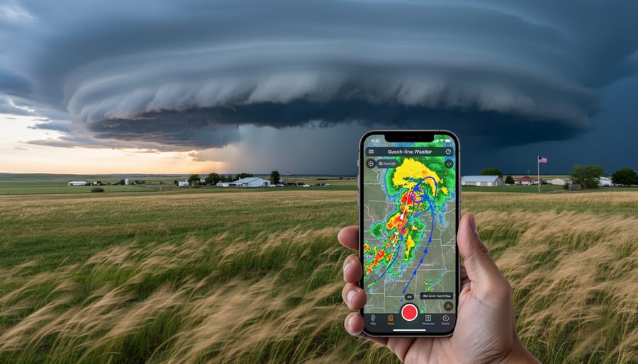
WeatherCAN is the starting point for anyone serious about tracking weather in southern Alberta. As Environment Canada’s official platform, it delivers the most authoritative radar data you can get for Strathmore and the surrounding region. This isn’t a third-party aggregator, you’re looking at the same information meteorologists use when they issue forecasts and warnings.
The official WeatherCAN radar offers interactive features that let you zoom directly into Strathmore, watch high-resolution animations of precipitation moving across the prairies, and see exactly what’s headed your way. You can toggle between different radar views, check current weather alerts for your area, and track storms as they develop. The animations are smooth enough to show you whether that band of rain is going to miss your farm or hit it in the next twenty minutes.
Because WeatherCAN pulls from the Strathmore Weather Radar station, which got a major upgrade in 2019, you’re getting longer-range coverage and more accurate readings than older systems provided. For planning your commute, deciding whether to bring in equipment, or just figuring out if you need an umbrella, this is the most reliable starting point available.
2. Strathmore Weather Radar Interactive Map
The Strathmore Weather Radar Interactive Map gives you a focused view of what’s happening overhead right now. This tool centers on Strathmore and the immediate surrounding area, making it simple to track precipitation as it develops and moves across the region.
You can see exactly where rain, snow, or ice is falling, with color-coded displays that show intensity at a glance. The map animates recent movement, so you’ll know whether a storm is heading your way or passing to the north. If you’re checking conditions before heading out to the fields or planning your commute into Calgary, this local focus saves you from scanning a province-wide map.
One practical feature: you can center the map on your current location, which is handy when you’re away from home and want to see what’s approaching your exact spot. The interface is straightforward enough that you don’t need to be a weather enthusiast to understand what you’re looking at. It’s designed for everyday Albertans who just want a quick, accurate picture of the storms rolling through southern Alberta today.
3. MyRadar: High-Definition Doppler for Detailed Tracking
MyRadar stands out for its stunning high-definition Doppler radar imagery, processed from raw NOAA weather data. While Environment Canada feeds power most local tools, MyRadar’s polished presentation and silky-smooth animations make tracking storms around Strathmore genuinely engaging rather than a chore.
The app shines when severe weather rolls in from the west or northwest, you can watch storm cells develop over the Rockies and move across the prairies in animated loops that update frequently. The mobile interface is intuitive enough that you won’t fumble with it while commuting in storms or checking conditions from the field.
What makes MyRadar particularly useful for southern Alberta residents is its coverage of cross-border weather systems. Since many of our weather patterns originate south of the border, having access to NOAA radar fills in gaps that purely Canadian sources might miss. You’ll spot approaching systems earlier and get a clearer picture of what’s headed your way, whether it’s a summer thunderstorm or a winter system tracking northeast through Montana into Alberta.
4. Environment Canada Weather Radar Map
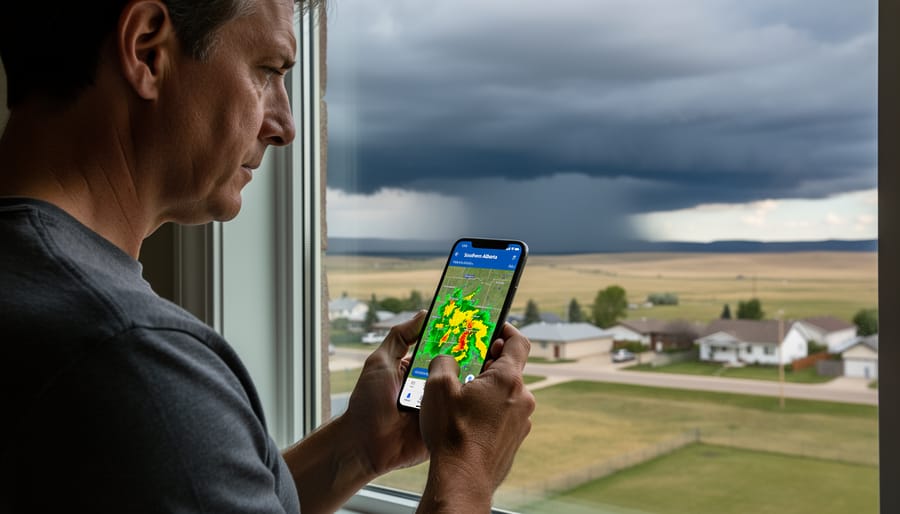
Environment Canada’s provincial radar map gives you the big picture across all of Alberta, making it invaluable when storms are building west of Strathmore or tracking in from the north. This tool shows precipitation type, rain, snow, or ice, layered over the entire province, so you can watch systems develop hours before they reach your area.
The map updates regularly throughout the day, letting you see how quickly storms are moving and whether they’ll intensify or fizzle out before hitting the Strathmore region. If you’re planning fieldwork, a commute to Calgary, or an afternoon soccer game, checking this broader view helps you decide whether to move up your timeline or wait it out.
Because it covers such a wide area, this radar is especially useful during Alberta’s notorious spring storm season when weather can change dramatically as systems cross the Rockies. You’ll spot approaching fronts while they’re still over the foothills, giving you a solid hour or two to adjust your plans. The interface is straightforward, just zoom into Strathmore and watch the colored bands shift across the map as precipitation moves through.
5. Local Weather Apps with Radar Integration
Mobile weather apps put Strathmore’s radar data in your pocket, which matters when you’re deciding whether to leave work early ahead of a storm or checking conditions before heading out to the farm. Several apps pull directly from Environment Canada’s radar network and translate that data into clean, user-friendly displays that update throughout the day.
WeatherCAN stands out as the official Environment Canada app. It delivers the same radar animations you’d get on the desktop site, plus push notifications when severe weather alerts hit your area. You can set Strathmore as your default location and get updates without opening the app, helpful when a thunderstorm warning drops while you’re mid-commute.
Other popular choices among southern Alberta residents include Weather Network and The Weather Channel apps, both of which integrate Environment Canada data for Canadian locations. They offer layered radar views that let you toggle between precipitation intensity, storm tracks, and forecast models. Most send customizable alerts, so you can choose to be notified about everything from freezing rain warnings to daily precipitation forecasts.
The real advantage here is portability. You’re not tied to a desktop when the sky darkens unexpectedly, and most apps cache recent radar frames so you can check the trend even if cell service is spotty.
6. Weather Radio Stations with Live Radar Updates
When severe weather sweeps toward Strathmore, visual radar tools tell only part of the story. Tuning into weather radio stations, especially Calgary Now’s presenters, adds crucial context during fast-changing conditions. These broadcasters interpret radar data live, explaining what approaching storm cells mean for your neighborhood, whether you need to stay safe outdoors or delay your commute, and how long the precipitation will last.
Radio stations bridge the gap between raw radar imagery and practical decisions. Presenters monitor the same radar maps you do, but they bring years of local knowledge, real-time listener reports from across the region, and direct contact with Environment Canada forecasters. During hail warnings or heavy snowfall, this combination of expert commentary and community input creates a fuller, more actionable picture than radar alone can provide.
7. Community Weather Spotters and Social Media
While radar tools show you what’s happening in the atmosphere, local weather spotters offer something just as valuable: what’s actually hitting the ground right now in your neighborhood. Around Strathmore, community members share real-time observations on platforms like Facebook, Twitter, and neighborhood groups, reporting hail size, wind damage, flooding, and road conditions as storms move through.
These hyper-local updates fill gaps that radar can’t always capture. A spotter might post that golf-ball-sized hail just started south of town, or that Highway 817 is flooding near Range Road 245, details that help you adjust plans immediately. Many southern Alberta weather groups welcome photos and short reports from residents, creating a live network of eyes on the ground.
Join local Strathmore weather discussion threads and follow active spotters who post during severe weather events. When you comment with your own observations, you’re contributing to the community’s collective awareness. Pair what you see on radar with these grassroots reports, and you’ll have the most complete picture of what’s actually happening around you.
Understanding What Radar Shows You
Radar maps use color coding to show where precipitation is falling and how intense it is. On most maps, green indicates light rain or drizzle, yellow shows moderate precipitation, and orange to red means heavy rain or snow. Dark red or magenta signals very intense precipitation, often hail or severe thunderstorms that warrant immediate attention.
The type of precipitation depends on temperature at the surface. Radar detects moisture in the air, but it can’t always tell if that’s rain, snow, or freezing rain. If temperatures near Strathmore are below freezing, green or yellow on the radar likely means snow. In mixed conditions during spring or fall, you might see rain transitioning to ice or snow as a system moves through.
Movement patterns tell you where a storm is headed. Most systems in southern Alberta travel from west to east, but checking the animation over the past hour shows the actual path. If a red or orange blob is creeping toward Strathmore from Calgary, you’ve got about 20 to 40 minutes to prepare. Radar updates every eight minutes around Strathmore, so refreshing the map gives you the latest picture without guessing.
Quick Answers About Strathmore Weather Radar
How often is radar data updated for Strathmore?
Radar data for Strathmore updates every 8 minutes, giving you near-current information on precipitation and storm movement. This frequent refresh helps you track changing weather conditions as they develop across the region.
Who provides the weather radar data?
Environment Canada operates and maintains the weather radar network across Alberta, including the Strathmore station. All official radar data you see on Canadian weather tools comes from this authoritative government source.
What’s the range of the Strathmore radar after its 2019 upgrade?
The 2019 upgrade equipped the station with new technology that extended its range and improved accuracy. While exact coverage varies by atmospheric conditions, the upgraded radar now tracks weather systems farther out, giving you earlier warning of approaching storms.
How accurate is radar for predicting storms?
Radar excels at showing what’s happening right now, where precipitation is, how heavy it is, and which direction it’s moving. It doesn’t predict future weather on its own, but watching a radar loop helps you anticipate when a storm will reach your area based on its current path.
Can I access weather radar on my phone?
Yes, all the tools mentioned in this article work on mobile devices. WeatherCAN, MyRadar, and other apps offer radar maps optimized for smartphones, letting you check conditions whether you’re at home or out around Strathmore.
These answers cover the basics most residents ask about when they start using radar tools. If you’re tracking a specific storm or planning outdoor work, combining radar data with Environment Canada’s forecasts gives you the fullest picture of what to expect.