Ontario’s air quality is in the low-risk range across all major monitoring stations as of 8:00 pm EDT on August 16, 2026, according to Environment and Climate Change Canada’s Air Quality Health Index. Readings from Barrie to Windsor, Ottawa to Grand Bend show AQHI values well within safe parameters, meaning no immediate health precautions are needed for most residents.
For Albertans, this matters more than you might think. When Ontario experiences wildfire smoke or air quality degradation, it often signals broader atmospheric patterns moving west. The AQHI scale runs from 1 to 10+, with current Ontario readings clustered at the lower end, a stark contrast to what many southern Alberta communities faced during recent wildfire seasons. Understanding how Environment Canada tracks and forecasts air quality in central Canada gives you a preview of tools and thresholds that apply here at home.
The latest forecasts, updated at 5:00 pm EDT on August 16, show no significant deterioration expected across Ontario’s 26 reporting stations, from Hamilton Mountain to North Bay. While that’s good news for Ontario residents today, Calgarians know how quickly smoke plumes can travel and how critical it is to monitor AQHI readings before outdoor activities, especially for children, seniors, and anyone with respiratory conditions.
What Changed: Ontario’s Air Quality Status as of August 16

As of 8:00 pm EDT on August 16, 2026, Environment and Climate Change Canada calculated Air Quality Health Index readings across Ontario that place every monitored community in the low-risk range. The data covers more than two dozen cities, from Barrie and Brampton in the south to North Bay and Parry Sound in the north, and from Windsor and Chatham in the southwest to Ottawa and Kingston in the east. Forecasts updated three hours earlier, at 5:00 pm EDT, show this pattern holding steady.
Low-risk readings mean outdoor air poses minimal health concerns for the general public. You can exercise outside, kids can play without worry, and commuters face no air quality barriers to their usual routines. The AQHI scale runs from 1 to 10+, with higher numbers indicating greater health risk from pollutants like ground-level ozone, particulate matter, and nitrogen dioxide. When readings stay low across an entire province, as they do now in Ontario, it signals clean air conditions with no immediate wildfire smoke impact, no urban smog buildup, and no weather patterns trapping pollutants near the surface.
For Alberta residents tracking eastern trends, these stable low-risk readings suggest Ontario isn’t currently experiencing the kind of smoke events that might drift westward in coming days. The consistent pattern from Hamilton to Cornwall tells us conditions are calm, which matters when you’re planning outdoor events or monitoring cross-country air quality shifts.
Key Developments
1. Environment Canada’s Real-Time AQHI Monitoring Across Ontario
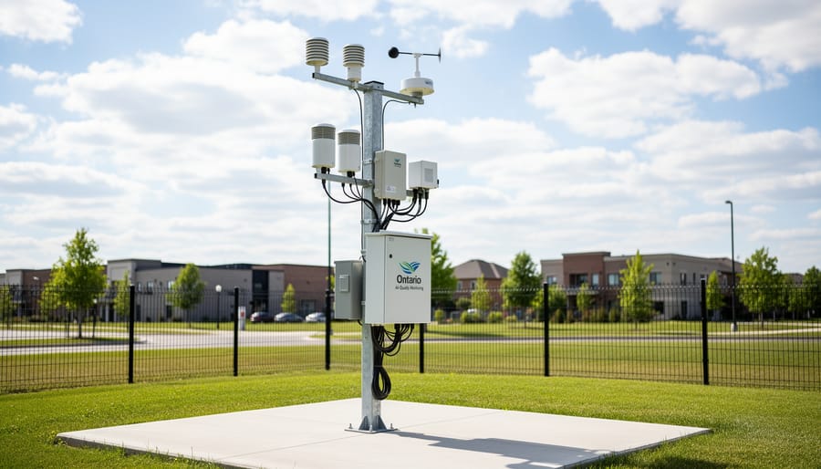
Environment and Climate Change Canada operates a comprehensive real-time monitoring network that tracks air quality across Ontario’s major population centres. As of 8:00 pm EDT on August 16, 2026, the agency calculated Air Quality Health Index readings for more than 26 communities throughout the province, with forecasts updated at 5:00 pm EDT the same day. This network provides hourly updates that help millions of residents make informed decisions about outdoor activities and health precautions.
The Air Quality Health Index uses a scale from 1 to 10+ to communicate health risks associated with air pollution. Readings combine measurements of three pollutants, ground-level ozone, nitrogen dioxide, and fine particulate matter, into a single number that reflects the immediate health risk. The scale divides into four risk categories: low (1-3), moderate (4-6), high (7-10), and very high (above 10). Environment Canada updates these calculations throughout the day as monitoring stations record new data from across the province.
Current readings across Ontario show consistently low-risk conditions in communities including:
- Barrie, Belleville, and Brampton in the Greater Toronto Area
- Burlington, Hamilton (Downtown, Mountain, and West), and Mississauga in the Golden Horseshoe
- Ottawa Downtown, Kingston, and Cornwall in eastern Ontario
- London, Kitchener, Guelph, and Brantford in southwestern Ontario
- North Bay, Parry Sound, and Dorset in cottage country
Alberta uses a similar provincial air quality monitoring system operated through the Alberta Capital Airshed alliance and other regional organizations, though the reporting structure differs slightly from Ontario’s centralized approach. Understanding how eastern provinces track and report air quality helps Alberta residents recognize patterns that might affect their own region, particularly when events like the recent Brampton air quality warning signal broader atmospheric conditions that could shift westward.
2. Provincial Air Quality Data Sharing Between Provinces
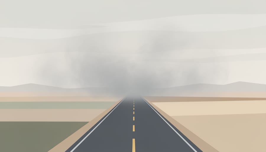
Air quality data doesn’t stop at provincial borders, and neither does wildfire smoke. Environment and Climate Change Canada coordinates air quality monitoring across the country, sharing data between provinces to help predict how smoke plumes and pollution move from east to west. When Ontario experiences heavy smoke from wildfires, whether local fires or smoke drifting in from Quebec, that same air mass often tracks westward over the following days and weeks, eventually affecting Manitoba, Saskatchewan, and Alberta.
Southern Alberta residents have learned this pattern well over recent wildfire seasons. Smoke that blankets Ontario today can arrive in Calgary within three to five days, depending on upper-level wind patterns. That’s why monitoring Ontario’s AQHI readings gives Albertans an early warning system. If eastern Canada shows a sudden spike in air quality concerns, it’s time to check real-time smoke maps and prepare for potential changes in local conditions.
This cross-country data sharing also helps meteorologists and health officials coordinate public messaging. When Environment Canada sees a large smoke event forming in one region, they can alert provinces downstream to watch for deteriorating air quality. For anyone with respiratory conditions or outdoor work planned, checking both local Alberta readings and upstream Ontario trends provides a fuller picture of what’s coming your way.
3. The Air Quality Health Index System Explained for Alberta Residents
The Air Quality Health Index runs from 1 to 10+ and divides into three risk categories: low (1-3), moderate (4-6), and high (7-10+). When Ontario reports readings in the low range, as all monitored cities show for August 16, 2026, it means air quality poses little immediate risk for outdoor activities. How AQHI is calculated takes into account three major pollutants: ground-level ozone, nitrogen dioxide, and fine particulate matter (PM2.5), which combine to create the single number you see in forecasts.
Alberta uses the same AQHI system, so the scale translates directly across provinces. The difference lies in typical pollutant sources: Ontario readings often reflect urban traffic and industrial emissions, while Alberta’s numbers fluctuate more dramatically during wildfire season. Understanding the system helps you compare conditions between provinces and recognize when smoke drifting from eastern wildfires might push Alberta’s AQHI from a comfortable 2 to a concerning 7 within days. Check both Environment Canada’s national network and Alberta’s provincial monitoring stations during peak fire season, since smoke can travel thousands of kilometres and arrive with little warning.
Why Ontario’s Air Quality Matters to Alberta
Understanding air quality patterns across Canada isn’t just about checking numbers, it’s about recognizing that our atmosphere doesn’t respect provincial boundaries. When wildfires burn in Ontario or Quebec, the smoke doesn’t stay put. Upper-level winds can carry fine particulate matter westward across the prairies, affecting southern Alberta’s air quality days or even weeks after eastern fires ignite.
This cross-country connection matters for everyday decisions. If you’re planning a weekend hike in Kananaskis or scheduling outdoor sports for your kids, knowing that Ontario is experiencing elevated smoke levels gives you advance warning that similar conditions might drift our way. The same weather systems that transport smoke also influence temperature and precipitation patterns, which is why Calgary Now’s weather coverage tracks these broader trends alongside local forecasts.
For Albertans with respiratory conditions, asthma, COPD, or heart disease, this early-warning approach is particularly valuable. Monitoring eastern air quality lets you prepare before smoke arrives, whether that means adjusting medication, rescheduling outdoor activities, or simply keeping windows closed.
The science is straightforward: prevailing westerlies usually push air from west to east across Canada, but upper-atmosphere jet stream patterns can reverse or redirect flow, especially during wildfire season. When Ontario shows deteriorating air quality from fires, checking wind forecasts for the next 72 hours tells you whether southern Alberta should brace for similar impacts.
That’s why keeping one eye on Environment Canada’s Ontario AQHI readings, even when they’re comfortably low, as they are today, helps you stay ahead of air quality shifts that could affect your health and plans right here at home.
What to Watch: Air Quality Trends for the Rest of August 2026
Check Environment Canada’s AQHI updates twice daily, morning and evening, to catch shifts before they affect your plans. The readings refresh throughout the day, with Ontario forecasts typically updated by late afternoon EDT, giving Alberta residents an early indicator of potential cross-country smoke patterns. Set a reminder to review air quality data if you’re planning outdoor activities or have respiratory sensitivities.
Alberta residents should bookmark both the national air quality map and Alberta-specific monitoring sites to compare eastern and western trends. When Ontario’s readings climb above the low-risk range, watch for weather patterns carrying smoke westward over the following week. The Environment Canada air tools provide province-by-province breakdowns that help you spot these developing patterns before they reach southern Alberta.
How often is the Air Quality Health Index updated?
Environment Canada updates AQHI calculations multiple times daily, with Ontario current readings typically refreshed in the morning and evening. Forecasts are generally updated by late afternoon Eastern time.
Where can Albertans check local air quality?
Visit Environment Canada’s national air quality page and filter for Alberta communities, or check the Alberta government’s air quality monitoring network for hyperlocal readings across the province.
What should I do when air quality changes?
Reduce outdoor exertion when readings climb above the low-risk range, especially if you have asthma or heart conditions. Move activities indoors or reschedule for days with better air quality.
How does wildfire smoke travel between provinces?
Prevailing westerly winds can carry smoke eastward, but high-altitude currents sometimes push eastern smoke westward over several days. Monitor multi-province trends to anticipate shifts affecting southern Alberta.
Pay attention to haze on the horizon and unusual sunset colours, early visual signs that smoke may be drifting into the region. If Ontario’s AQHI readings spike above 6 while Alberta remains clear, track weather systems moving west. This pattern often precedes deteriorating air quality in Calgary and surrounding areas within three to five days, though local conditions vary. Stay tuned to Calgary Now’s weather updates for real-time alerts tailored to southern Alberta, and consider signing up for Environment Canada notifications if you need immediate warnings for health reasons.
Ontario’s air quality remains in the low-risk range as we head into late August 2026, but that doesn’t mean southern Alberta residents can stop paying attention. What happens in eastern Canada often becomes our problem a week or two later when weather patterns shift and wildfire smoke drifts westward across the provinces. Understanding how Environment and Climate Change Canada tracks air quality trends gives us valuable early warning signals for what might be coming our way.
Keep checking Calgary Now’s weather updates throughout the day, especially during wildfire season when conditions can change quickly. Environment Canada’s real-time air quality data for both Ontario and Alberta gives you the bigger picture, not just what’s happening overhead right now, but what’s building thousands of kilometres away. If you’ve noticed unusual haze, experienced breathing difficulties during recent smoke events, or have questions about protecting your family’s health when air quality drops, call in and share your story with our radio presenters. Your experiences help the whole southern Alberta community stay informed and prepared.