Tracking hurricanes from Alberta might seem like watching distant storms, but the Canadian Hurricane Centre provides free, real-time tools that let you monitor these powerful systems as they develop and move through Atlantic waters. Whether you’re planning travel to Canada’s east coast, have family in hurricane-prone regions, or simply want to understand these major weather events, you can access the same official data that meteorologists use through Environment and Climate Change Canada’s online resources. The process takes less than five minutes: navigate to the Canadian Hurricane Centre’s Hurricane Track Information page, where you’ll find live satellite imagery, current storm positions, and forecast tracks updated throughout the day.
While hurricanes rarely impact southern Alberta directly, understanding how to read these tracking tools helps you stay informed during the Atlantic hurricane season, which typically runs from June through November. The Canadian Hurricane Centre issues official track forecasts and defines hurricane response zones for all tropical systems that could affect Canadian waters or coastal communities. These aren’t consumer-grade approximations but the actual technical data used by emergency management teams across the country.
For Calgary residents with connections to Atlantic Canada or those planning Maritime travel, knowing how to interpret hurricane tracker maps provides peace of mind and practical planning information. The tracking systems pull from multiple meteorological sources and update continuously as conditions change, giving you access to the most current storm projections available.
What You’ll Need to Track Hurricanes Effectively
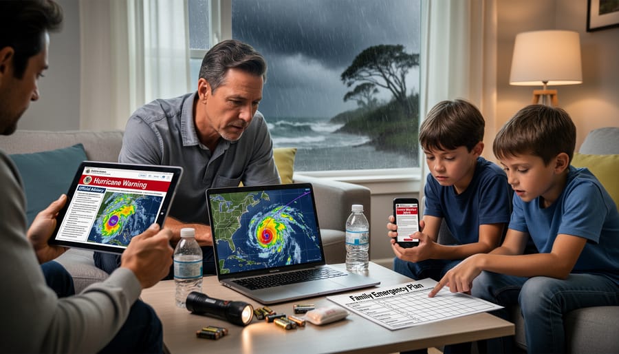
Tracking hurricanes effectively doesn’t require specialized equipment, but you do need access to the right official resources and a basic understanding of where to find them. Most Canadians already have what they need: an internet-enabled device and knowledge of which government platforms to trust.
Here’s what you’ll need to track hurricanes in Canada:
- Internet access through a computer, tablet, or smartphone
- The Canadian Hurricane Centre website for official track forecasts and technical discussions
- Environment and Climate Change Canada’s weather alert system for 24/7 warnings
- Access to satellite and radar tools through government platforms
- Optional: a battery-powered weather radio as a backup if internet access fails
The Canadian Hurricane Centre serves as your primary resource. It provides the Hurricane Track Information map, which displays current and forecast positions for all storms being monitored. You’ll also find Technical Discussions with meteorological details, storm track tables, and the reasoning behind each forecast. Environment and Climate Change Canada supplements this with their broader weather alert infrastructure, which pushes critical warnings directly to Canadians around the clock.
Mobile access is particularly valuable because hurricane situations can evolve while you’re away from home. Both the Canadian Hurricane Centre and Environment Canada maintain mobile-friendly websites that load quickly even on cellular data. You don’t need to download third-party apps, which can be unreliable or present outdated information.
While satellite and radar imagery are available through official channels, you don’t need meteorology training to use them. These visual tools help you see the storm’s actual structure and movement in near-real time, confirming what the forecast maps predict. A weather radio provides crucial backup during power outages, when internet access might be unavailable but you still need updates.
Important Safety Considerations Before You Begin
Before you start tracking hurricanes, understand that these forecasts are sophisticated predictions, not guarantees. The cone-shaped uncertainty zones you’ll see on official maps represent where the storm’s center is most likely to travel, but the entire cone shows possible paths, and impacts extend well beyond that area. Weather systems are complex, and even with advanced modeling, the track can shift significantly with just a 12-hour update.
When tracking, stick exclusively to official Canadian sources like the Canadian Hurricane Centre and Environment and Climate Change Canada. Social media posts, unofficial weather sites, and outdated maps can spread dangerous misinformation during rapidly-changing situations. You’re looking for situational awareness, not DIY forecasting. The same principle applies to other weather monitoring tools, checking a live weather radar keeps you informed, but professional meteorologists interpret the broader picture.
Think of hurricane tracking as staying informed so you can act quickly when authorities issue warnings, not as a way to second-guess official guidance. If Environment Canada issues a hurricane warning or local emergency officials order evacuation, that’s your signal to stop monitoring and start moving. Your role is to be prepared and aware, not to decide whether the forecast is “right” based on the current track position.
Step-by-Step: How to Track Hurricanes Using Official Canadian Resources
Understanding the Hurricane Track Information Map
The hurricane track information map from the Canadian Hurricane Centre shows you where storms are now and where they’re forecast to go. At first glance, it looks complex, but you only need to focus on a few key elements.
The map displays colored lines representing each storm’s path. A solid line shows where the hurricane has already traveled, while a dashed or projected line indicates the forecast track. The wider the cone around that forecast line, the greater the uncertainty about exactly where the center will go. This cone doesn’t show the storm’s size, it shows possible paths. Even communities outside the cone can experience impacts like heavy rain and wind.
Look for symbols along the track, typically circles or squares, which mark the storm’s location at specific times. The colors often indicate intensity: yellows for tropical depressions, oranges for tropical storms, and reds or deeper colors for hurricane strength. Check the map’s legend to confirm what each symbol means.
The hurricane response zone appears as a highlighted area, usually shaded in pink or another distinct color. If your region falls within this zone, Environment and Climate Change Canada is actively monitoring potential impacts. This doesn’t guarantee the storm will hit you directly, but it signals you should stay alert and prepare for possible severe weather.
The map updates regularly as new forecasts are issued, so refresh the page to see the latest track changes. Each update can shift the projected path significantly, especially several days out.
Reading Technical Discussions and Forecast Details
The Technical Discussion section contains the most detailed meteorological information about each tracked storm. While it looks intimidating at first, you don’t need a meteorology degree to extract useful insights.
Start by scrolling to the Technical Discussion link on the Canadian Hurricane Centre’s main tracking page. This section opens with a plain-language summary explaining the current situation in the first few sentences. Read this overview carefully, it tells you what meteorologists expect the storm to do and why.
Below the summary, you’ll find storm track tables showing projected positions at specific times. These tables list coordinates, wind speeds, and pressure readings. Focus on the wind speed column to gauge intensity changes and the time stamps to understand how quickly the storm is moving.
The forecast rationale section explains the reasoning behind the predictions. Look for phrases like “high confidence” or “considerable uncertainty”, these tell you how reliable the forecast is. If meteorologists mention steering currents, upper-level winds, or atmospheric pressure patterns, they’re describing the forces pushing the storm in a particular direction.
Don’t get bogged down in technical jargon. Extract the key points: where the storm is heading, how strong it’s expected to get, and how confident forecasters are in their predictions. Check back every six hours, as the Canadian Hurricane Centre updates these discussions regularly when systems threaten Canadian waters.
Using Satellite and Radar Imagery
Once you’ve read through the technical discussion and reviewed the track map, the satellite and radar imagery adds another layer of insight. These visual tools show you what the storm actually looks like right now, not just where forecasters predict it will go.
On the Canadian Hurricane Centre’s Hurricane Track Information page, look for the “Latest Satellite Images” and “Latest Radar Image” links near the tracking map. Click through to see the most recent views of the storm system. Satellite imagery gives you a bird’s-eye view of the hurricane’s cloud structure, you’ll see the distinctive spiral bands, the eye if it’s well-formed, and how organized or ragged the system appears. A tight, symmetric spiral with a clear eye typically means a stronger, better-organized storm. Looser, more scattered clouds suggest a weaker or disorganizing system.
Radar imagery is particularly useful once a hurricane gets closer to land. It shows precipitation intensity in real time, helping you see which areas are getting hammered by heavy rain and which might catch a break. The brightest colors (usually reds and purples) indicate the most intense rainfall.
Don’t expect to become a meteorologist overnight, but these images help you verify that what you’re seeing on the tracking map matches the storm’s actual behaviour. If the forecast says the hurricane is weakening but satellite shows a strengthening eye, that’s useful context. Check back every few hours as conditions change rapidly.
Verifying Your Tracking and Knowing When to Act

Cross-checking your information is essential when tracking hurricanes. The Canadian Hurricane Centre updates its forecasts regularly, but not every source reflects those changes at the same speed. Always verify updates directly from the Canadian Hurricane Centre and Environment and Climate Change Canada rather than relying on a single website or social media post. Compare the forecast timestamp on the Hurricane Track Information map with the latest Technical Discussion to confirm you’re viewing current data. If the times don’t match, refresh the page or check back in a few minutes.
Environment and Climate Change Canada maintains weather alerts available 24/7 for all regions. These alerts include hurricane watches and warnings, which carry specific meanings. A watch means hurricane conditions are possible within 36 hours; a warning means they’re expected within 24 hours. When you see a warning issued for your region, it’s time to stop tracking and start acting.
Recognizing when forecasts change significantly matters just as much as monitoring the storm itself. If the forecast cone shifts direction, the storm strengthens rapidly, or the arrival time accelerates, those changes demand your attention. The same principles of extreme weather safety apply here: official warnings always take priority over your own interpretation of the data.
Local emergency management agencies will issue evacuation orders based on the latest forecasts and local conditions. When those orders come, tracking becomes secondary. Your focus should shift to what to do next securing your property, gathering emergency supplies, and following evacuation routes. Hurricane tracking is a tool for awareness and preparation, not a substitute for heeding official emergency instructions when they’re issued.
Common Questions About Hurricane Tracking in Canada
How often are hurricane tracks updated by the Canadian Hurricane Centre?
The Canadian Hurricane Centre updates hurricane tracks and forecasts multiple times daily when systems are active, with more frequent updates as storms approach Canadian waters. During significant events, forecasts may be issued every few hours, and the online Hurricane Track Information map reflects the latest available data.
Can I use U.S. tracking sites like the National Hurricane Center for Canadian storms?
Yes, the National Hurricane Center provides valuable tracking data, and the Canadian Hurricane Centre even links to it on their Hurricane Track Information page. However, always cross-reference with Canadian Hurricane Centre forecasts for information specific to Canadian impacts and the hurricane response zone.
Are there official mobile apps from Environment Canada for hurricane tracking?
Environment and Climate Change Canada’s WeatherCAN app provides access to weather alerts 24/7, including hurricane warnings and watches. While the app doesn’t replicate the full online Hurricane Track Information map, it delivers critical alerts and weather updates directly to your phone.
What should I do if I lose internet access during a storm?
Switch to radio and television broadcasts for updates, as Environment and Climate Change Canada issues alerts through multiple channels. Local emergency management offices also broadcast warnings through sirens and emergency alert systems that don’t require internet connectivity.
One question many Albertans ask is whether they need to track hurricanes at all. While hurricanes rarely affect southern Alberta directly, understanding how to track storms matters if you’re traveling to Atlantic Canada, have family on the east coast, or want to stay informed about major national weather events. The tracking skills you develop also transfer to monitoring other severe weather systems that do impact Alberta, from winter storms to severe thunderstorm complexes.
Another common concern is whether satellite and radar imagery requires special training to interpret. The Canadian Hurricane Centre provides both technical meteorological products and more accessible visual tools. You don’t need a meteorology degree to see whether a storm is strengthening or weakening, moving faster or slower, or tracking north versus northeast on the satellite images. The colored tracks on the Hurricane Track Information map and the latest radar images give you visual confirmation of what’s happening, even if you skip the detailed technical discussions.
Tracking hurricanes is about more than watching colorful maps update. It’s about protecting yourself, your family, and your community when severe weather threatens. By learning to use the Canadian Hurricane Centre’s tools and understanding what those forecast tracks really mean, you’ve equipped yourself with a skill that could genuinely matter when conditions turn dangerous.
But here’s the critical part: tracking is only valuable when it leads to smart action. No matter how confident you feel reading those forecast cones, always defer to official warnings and emergency instructions. If authorities issue evacuation orders, go. If Environment and Climate Change Canada upgrades a watch to a warning, take it seriously. Your interpretation of a satellite image can’t replace the expertise of meteorologists who do this for a living.
Bookmark the Canadian Hurricane Centre’s tracking page now, before you need it. Share what you’ve learned with neighbors and family members, especially those in Atlantic Canada who face these threats regularly. And remember that staying informed about all kinds of weather, from prairie storms to distant hurricanes, is what we’re here for at Calgary Now. When conditions change, you’ll know where to look and what to do.